

Hover over image to zoom
Map of British Antarctic Expedition 1907
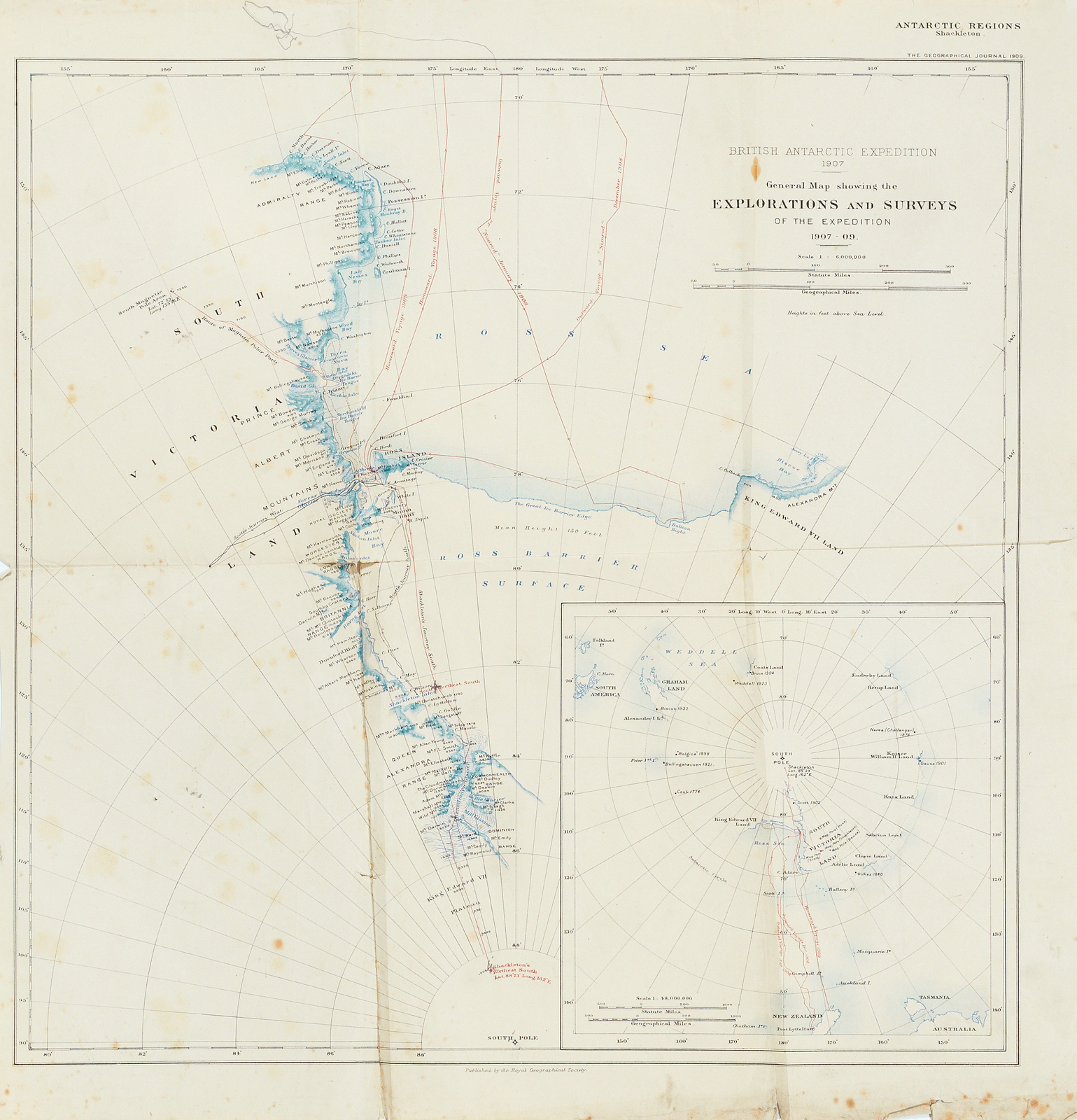
Map. British Antarctic Expedition 1907. General map showing the explorations and surveys of the expedition 1907-09. 1:6,000,000. Published by the Royal Geographical Society, in relation to the Earnest Shackleton led Nimrod Expedition. Penciled addition on map and trigonometrical calculation on back. Belonging to a collection of papers associated with William Colbeck, Captain of the "Morning", which made two trips to Antarctica as a relief vessel for the "Discovery" during the British National Antarctic Expedition 1901-1904.
| Number: | DUNIH 1.069 |
| Name: | Map of British Antarctic Expedition 1907 |
| Date: | 1907 |
| Maker: | Royal Geographical Society |
| Location: | In Store |